Pedestrian and bicycle mobility studies/
How to ensure that pedestrians and cyclists move freely and safely/
Walking and cycling are the most sustainable forms of travel and therefore the most important to be encouraged.
We are all pedestrians at least at one time or another of the day and the better the space (sidewalk width, adapted garage entrances, safe crossings, etc.) the more naturally we will use it.
The use of bicycles for daily urban and interurban travel has been on the increase in recent years. Nonetheless, it is necessary to ensure that all users have an infrastructure available that offers them guarantees for themselves and so as not to harm other road users either through their own circulation or because of shared space.

Accessibility
plans

An accessibility plan consists of identifying architectural barriers in various municipal areas (public roads, buildings, transports and communication), suggesting solutions to eliminate these, budgeting these measures and drawing up a progressive implementation plan based on previously established priority criteria. The goal is to achieve a fully accessible municipality in a rational and planned manner.
Cinesi uses geographic information system (GIS) tools that help link data with its geographical location to facilitate the management of developing this plan. Queries can therefore be made about accessible itineraries, the data to properly develop the stage plan can easily be updated and plans visually displaying the information can be obtained.

School
routes
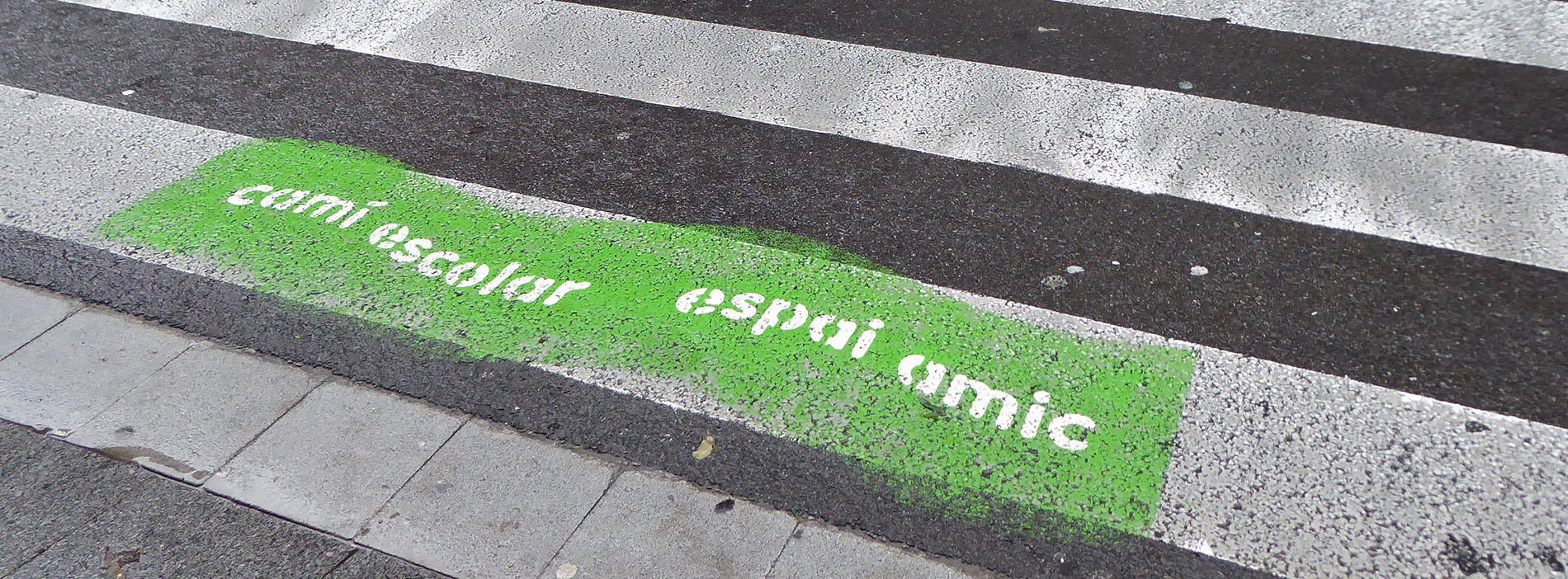
The main aim of school routes is to provide students with safe, comfortable itineraries on their way from home to school. It is a participatory, crosscutting project in which it is vital that the school and parent associations reach an agreement and participate in working together on the plan, as well as families also becoming involved.
The mobility habits of students must be studied in order to implement a school route. Based on this data, a technical action plan is developed to improve the streets around the school to make the access routes more pleasant and secure.
The process involves performing the following tasks:
- Checking the layout of nearby streets
- Improving traffic control to make it more secure
- Modifying the location of street furniture that may be an obstacle for pedestrians
- Painting the “School Route” logo on pedestrian crossings.

Traffic
calming
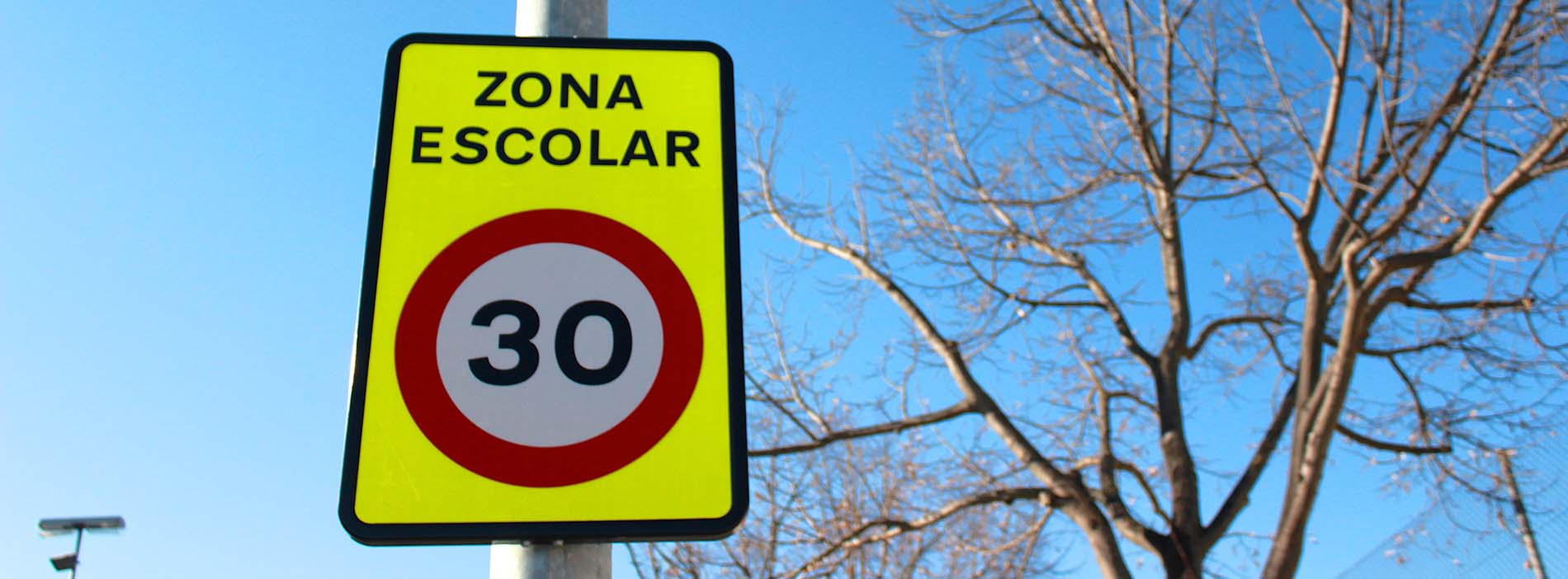
Traffic calming consists of actions aimed at reducing the effects of traffic on other road users and neighbours, such as improving security, reducing noise, etc.
Traffic calming specifically helps to reduce the speed of motor vehicles, deter traffic on more residential streets, encourage the sharing of the road with various modes of transport, minimise conflicts among users and consequently create a user-friendlier neighbourhood.

Signage
for pedestrians
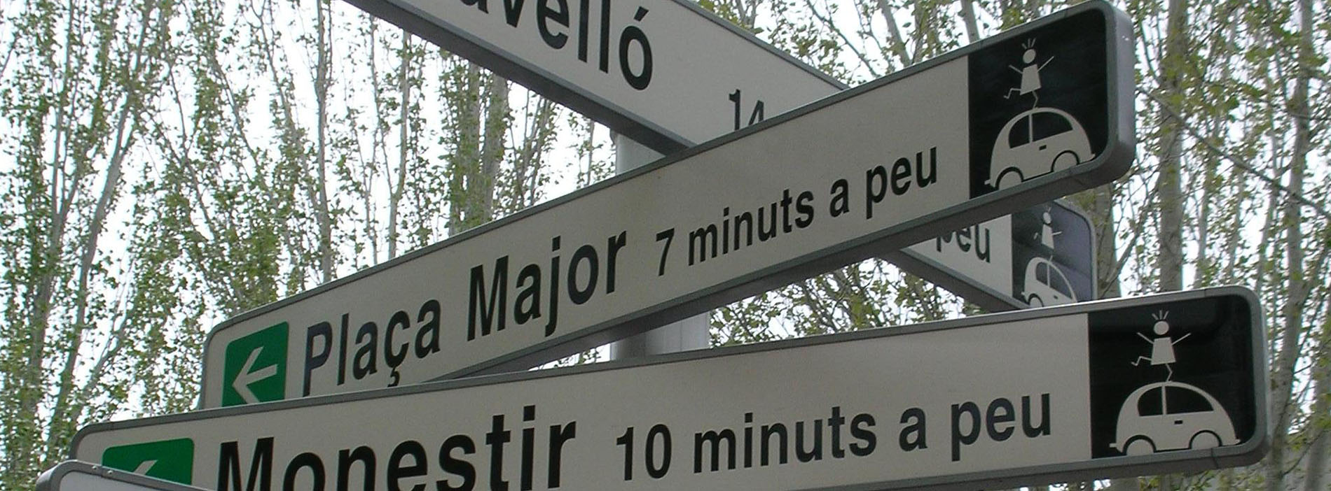
The move towards a sustainable mobility model means that there is a more intensive use of public space in our cities, with new mobility players and an exponential growth of non-motorised travel, with more traffic calmed spaces and single platform or reduced speed streets.
Signage aimed at pedestrians is an essential service of towns and cities for both their inhabitants and visitors alike and greatly contributes to their image.
Cinesi uses GIS tools that help link data with its geographical location to facilitate the management of developing a signage plan for pedestrians.

Planning of
bicycle lane network

The planning of a bicycling network is a key aspect for the future development of this means of transport and must be consistent at a territorial level.
Bicycle lanes must be functional and safe for users, while at the same time be adapted to the territory and its needs in order to maximise the network effect and provide an uninterrupted connection.
Bicycle master plans are documents that help address all these aspects based analysing cycling mobility, defining criteria and objectives and studying alternative routes. It is very important to include all the stakeholders involved in order to ensure technical, social and political consensus.
Cinesi has been a BYPAD (Bicycle Policy Audit) auditor for more than 10 years and this has allowed it to assess bicycle transport policies and quality management in a systematic manner in territories such as Donostia – San Sebastián, the island of Menorca or the town of Mataró.

Signage
for bicycles

The signage of bicycle lanes and paths regulates user circulation and orientation in order to guarantee the safety, comfort and efficiency of journeys.
In an environment where the presence of bicycles is becoming increasingly greater, it is also vitally important to ensure their coexistence with other modes of transport that are present on public roads.
Cinesi provides regulatory and planning advice for bicycle lanes and paths, including traffic lights, vertical and horizontal signage, information panels and road signage.

Bicycle
parking

It is important to improve bicycle paths and also provide comfortable and secure car parks at the origin and destination of journeys and near the main centre of attraction (places of work, education, sport, commerce, culture, etc.) in order to promote bicycle use in cities.
Cinesi offers a proven methodology for creating and/or improving bicycle parking spaces as well as solutions to the difficulty of creating new parking spaces, proposing strategies for the reuse and transformation of spaces currently used for private vehicles.

Electric
bicycles

Public administrations can subsidise the purchase of electric bicycles with the aim of supporting a shift in mobility towards a model in which the bicycle is a habitual mode of transport for daily travel in urban centres.
Cinesi provides support in administratively managing these subsidies by carrying out the following tasks:
- Receiving and validating subsidy application documents
- Resolving subsidy applications
- Receiving and analysing mobility questionnaires of legal entities wishing to apply for the subsidy
- Mediating with partner entities (bicycle shops, etc.)
- Creating database of applicants and subsidies
- Drawing up monitoring reports
Tools/
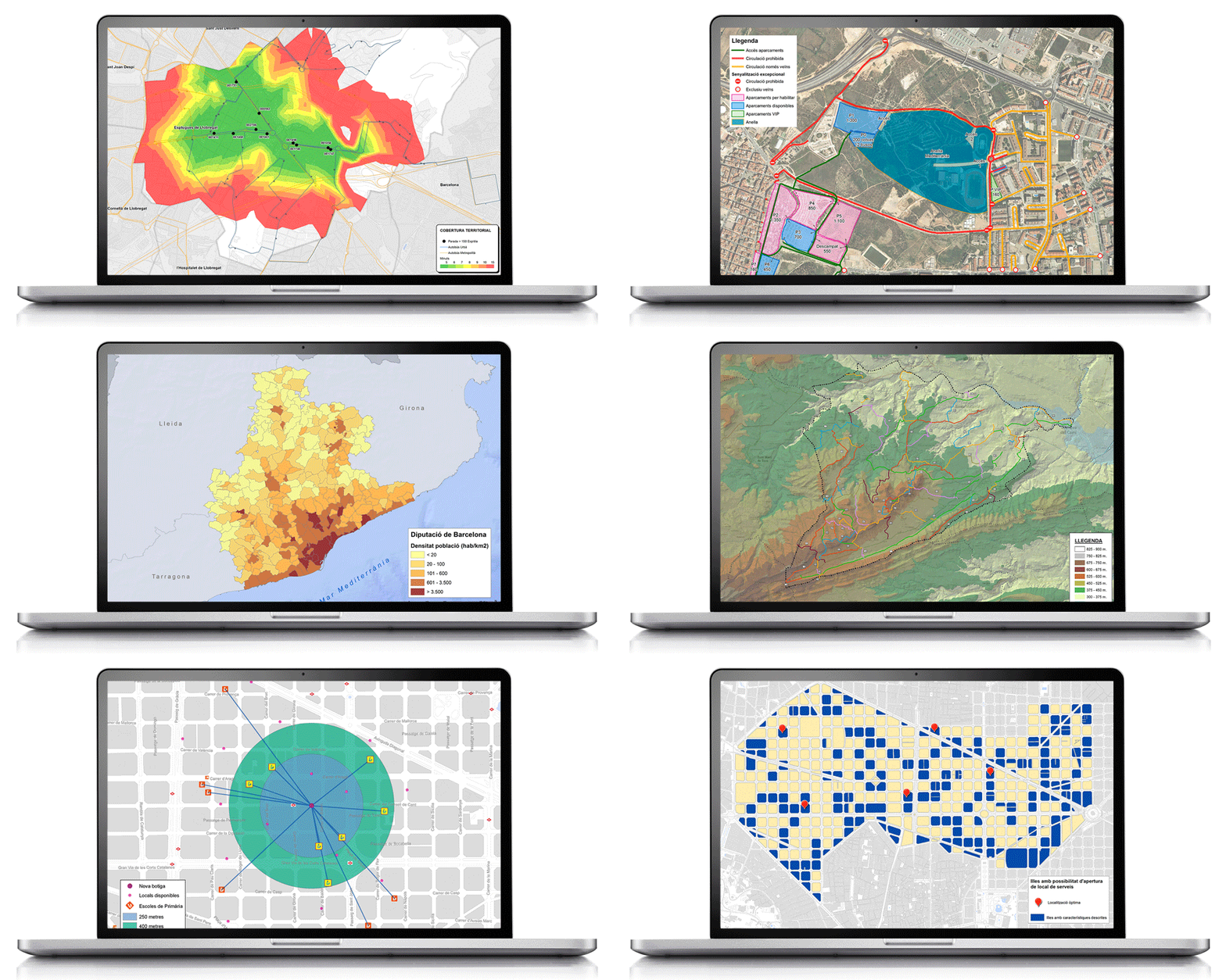
A geographic information system (GIS) is a sophisticated analytical tool we commonly use that is part of a number of new information technologies. It is a system that can store, analyse and display geographical information. It therefore has the peculiarity of integrating the variable of space, which makes it a very powerful tool to support any type of study or project in order to help in the decision-making process.
In the above charts you can see some of its applications in Cinesi’s projets.
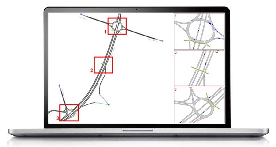


Simulation models are very useful computer programs that help to plan and manage transport. Their applications include network analysis, passenger transport analysis, the creation of demand and transport planning models, the design of vehicle routes and logistics and also territorial management, among others.
Here at Cinesi we use two simulation models according to the field of study: TransCAD for macroscopic fields and AIMSUN for smaller fields.
TransCAD: This is a macroscopic simulation model that is primarily used to study mobility on supramunicipal roads. The program uses a geographic information system (GIS) to help store and analyse data for any type of transport.
AIMSUN: This is a microscopic simulation model used to study mobility in urban networks. It allows vehicle-to-vehicle tracking and visualisation of this in real time. The impact of future actions on road networks can be observed based on the simulation of various modes of transport and the visualisation of how various stakeholders circulate, thereby helping to identify potential conflict points.
AUTOTURN: Simulation model of turning vehicles and analysis of sweeping areas based on the current or future road geometry for light and heavy vehicles and buses.
Cinesi performs a variety of fieldwork tasks to obtain both mobility data and information on the state of networks. Here are just a few:
1. Capacity/
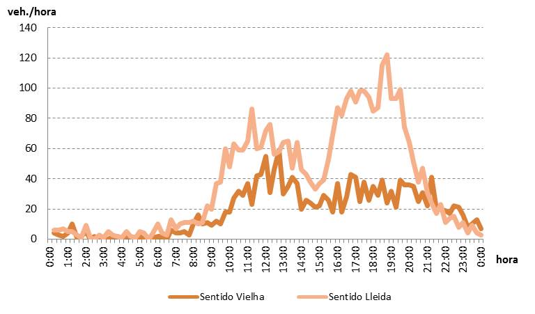
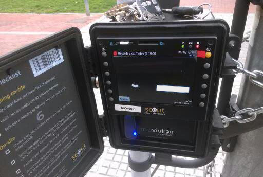
Automated. Automated capacity machines to record traffic intensity and vehicle speed. They help calculate hourly and daily changes by type of vehicle and circulation direction.


Directional. Helping to identify the route of pedestrians, bicycles, private vehicles, heavy vehicles, etc.


License plate reading. In order to obtain the route of motor vehicles by controlling access and intermediate checkpoints.


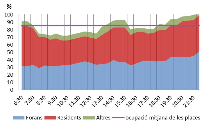
Parking. Analysis of occupancy (times that each space is occupied) and rotation (number of parked vehicles), identification of residence of vehicles parked and parking illegalities.


2. Inventories/
Analysis of the physical aspects of networks and photographic and/or video gathering that helps to define the condition of each section in a highly visual manner. Cinesi has the following specific material resources for conducting inventories:
4-wheel-drive vehicle. This vehicle incorporates a odometer and inclinometer to measure the length and tilt of the route, as well as a GPS receiver.
—


ArcGIS Field Maps. A mobile application that streamlines the process of accurate data gathering to be processed in the office during fieldwork.


Cinesi also specialises in monitoring and analysing surveys to identify mobility habits. These are a vital source for supporting the diagnoses and action plans we propose and can be outsourced to market research companies, with Cinesi overseeing these, or directly undertaken by Cinesi with contracted staff for the occasion. We handle the following tasks:
- Designing the survey by taking into account the objectives to be extracted
- Selecting the sample either randomly or from a particular group
- Conducting the survey, if required
- Data entry, if required
- Exploiting the obtained databases


The mysterious shopper technique helps to obtain detailed information on the conditions of providing a transport service. It is a vital tool for measuring, analysing and improving aspects related to customer service.
Acting anonymously as regular customers, specialised evaluators assess key aspects related to the perception of service users, such as information on board and at stops, quality of driving, stare of cleanliness and maintenance inside and outside the vehicles and also at stops, etc.
The resulting report presented by Cinesi includes all the information gathered, including quantitative and qualitative assessments and corresponding recommendations for improvement.


The pollutants emitted into the air by transport have a negative impact on the environment, so it is extremely important to identify and quantify their magnitude in order to implement measures.
Cinesi calculates emissions and environmental indicators based on (urban and interurban) transport networks and the environmental targets in question, thereby helping to compare modal quotas and existing emissions with those forecast in future scenarios.
One of the tools we use is AMBIMOB 2.0, from the Ministry of the Environment and Sustainability, which helps to environmentally assess the measures of sustainable urban mobility plans (SUMPs), thereby helping to observe the contribution of the measures with the planned reductions in mobility master plans, as well as the variation in emissions according to each pollutant.


—
—
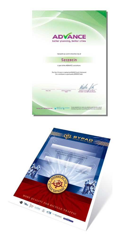
ADVANCE Audit is a certification tool for improving sustainable urban mobility plans, analysing the strengths and weaknesses of a city’s current mobility planning and providing directions on how to improve this in terms of sustainability.
—
—
There are a great many benefits for cities participating in the process of ADVANCE certification:
—
- Receiving an ADVANCE Action Plan containing action recommendations
- Benchmarking with other municipalities at a European level
- Improving the image of a city by showing that it is innovative and sustainable
- European recognised ADVANCE certification
—
—
BYPAD, an acronym for Bicycle Policy Audit, is a tool developed by an international consortium of bicycle experts as part of an EU-funded project. BYPAD provides an overview of the measures and structures applied in local cycling policy.
—
Cinesi uses it to be able to assess the quality of cycling policies of cities by analysing their strengths and weaknesses and making specific recommendations on how to improve their cycling policy in the future.


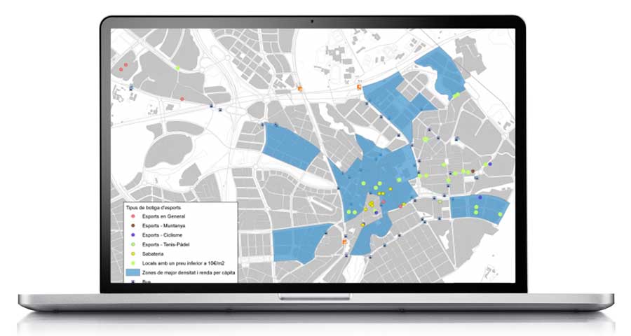
Geomarketing can be defined as the technique of analysing how geographical variables affect a business or activity. Geolocation and geospatial analysis help us to obtain an overview of the customers or users of a particular amenity, business, means of transport, etc.
It is a vital tool for answering such important questions as: Where are my customers and how do they behave? Where is the competition? Where can I open a new business? Or how accessible is my location and what geographical coverage do I have?
Cinesi is well versed in the tools of geomarketing and knows how useful it is for companies to obtain an accurate picture of the behaviour and mobility of their customers.
—


Analysis of major variables:
The analysis of major variables (demand, competition, area of influence or accessibility, among others) helps to obtain precise knowledge of the current situation and be able to make the right decisions regarding the optimal location to open an establishment, to identify the potential customer engagement area or the location of competitors.
—
Analysis of specific needs:
Based on studying the major variables of a business, geomarketing is also very useful for analysing specific, very concrete needs, such as:
- Distribution routes and points of sale
- Areas of influence of transport networks
- Reorganisation of points of sale or branches
- Studying cannibalisation areas
- Identifying areas not covered by a market network
- Mailshots and mailing
—
Tools/


A geographic information system (GIS) is a sophisticated analytical tool we commonly use that is part of a number of new information technologies. It is a system that can store, analyse and display geographical information. It therefore has the peculiarity of integrating the variable of space, which makes it a very powerful tool to support any type of study or project in order to help in the decision-making process.
In the above charts you can see some of its applications in Cinesi’s projets.


Simulation models are very useful computer programs that help to plan and manage transport. Their applications include network analysis, passenger transport analysis, the creation of demand and transport planning models, the design of vehicle routes and logistics and also territorial management, among others.
Here at Cinesi we use two simulation models according to the field of study: TransCAD for macroscopic fields and AIMSUN for smaller fields.
TransCAD: This is a macroscopic simulation model that is primarily used to study mobility on supramunicipal roads. The program uses a geographic information system (GIS) to help store and analyse data for any type of transport.
AIMSUN: This is a microscopic simulation model used to study mobility in urban networks. It allows vehicle-to-vehicle tracking and visualisation of this in real time. The impact of future actions on road networks can be observed based on the simulation of various modes of transport and the visualisation of how various stakeholders circulate, thereby helping to identify potential conflict points.
Cinesi performs a variety of fieldwork tasks to obtain both mobility data and information on the state of networks. Here are just a few:
1. Capacity/
Automated. Automated capacity machines to record traffic intensity and vehicle speed. They help calculate hourly and daily changes by type of vehicle and circulation direction.


Directional. Helping to identify the route of pedestrians, bicycles, private vehicles, heavy vehicles, etc.


License plate reading. In order to obtain the route of motor vehicles by controlling access and intermediate checkpoints.


Parking. Analysis of occupancy (times that each space is occupied) and rotation (number of parked vehicles), identification of residence of vehicles parked and parking illegalities.


2. Inventaries/
Analysis of the physical aspects of networks and photographic and/or video gathering that helps to define the condition of each section in a highly visual manner. Cinesi has the following specific material resources for conducting inventories:
4-wheel-drive vehicle. This vehicle incorporates a odometer and inclinometer to measure the length and tilt of the route, as well as a GPS receiver.
—


Collector for ArcGIS. A mobile application that streamlines the process of accurate data gathering to be processed in the office during fieldwork.


Cinesi also specialises in monitoring and analysing surveys to identify mobility habits. These are a vital source for supporting the diagnoses and action plans we propose and can be outsourced to market research companies, with Cinesi overseeing these, or directly undertaken by Cinesi with contracted staff for the occasion. We handle the following tasks:
- Designing the survey by taking into account the objectives to be extracted
- Selecting the sample either randomly or from a particular group
- Conducting the survey, if required
- Data entry, if required
- Exploiting the obtained databases


The mysterious shopper technique helps to obtain detailed information on the conditions of providing a transport service. It is a vital tool for measuring, analysing and improving aspects related to customer service.
Acting anonymously as regular customers, specialised evaluators assess key aspects related to the perception of service users, such as information on board and at stops, quality of driving, stare of cleanliness and maintenance inside and outside the vehicles and also at stops, etc.
The resulting report presented by Cinesi includes all the information gathered, including quantitative and qualitative assessments and corresponding recommendations for improvement.


The pollutants emitted into the air by transport have a negative impact on the environment, so it is extremely important to identify and quantify their magnitude in order to implement measures.
Cinesi calculates emissions and environmental indicators based on (urban and interurban) transport networks and the environmental targets in question, thereby helping to compare modal quotas and existing emissions with those forecast in future scenarios.
One of the tools we use is AMBIMOB 2.0, from the Ministry of the Environment and Sustainability, which helps to environmentally assess the measures of sustainable urban mobility plans (SUMPs), thereby helping to observe the contribution of the measures with the planned reductions in mobility master plans, as well as the variation in emissions according to each pollutant.
ADVANCE Audit is a certification tool for improving sustainable urban mobility plans, analysing the strengths and weaknesses of a city’s current mobility planning and providing directions on how to improve this in terms of sustainability.
—
There are a great many benefits for cities participating in the process of ADVANCE certification:
—
- Receiving an ADVANCE Action Plan containing action recommendations
- Benchmarking with other municipalities at a European level
- Improving the image of a city by showing that it is innovative and sustainable
- European recognised ADVANCE certification


BYPAD, an acronym for Bicycle Policy Audit, is a tool developed by an international consortium of bicycle experts as part of an EU-funded project. BYPAD provides an overview of the measures and structures applied in local cycling policy.
—
Cinesi uses it to be able to assess the quality of cycling policies of cities by analysing their strengths and weaknesses and making specific recommendations on how to improve their cycling policy in the future.


Geomarketing can be defined as the technique of analysing how geographical variables affect a business or activity. Geolocation and geospatial analysis help us to obtain an overview of the customers or users of a particular amenity, business, means of transport, etc.
It is a vital tool for answering such important questions as: Where are my customers and how do they behave? Where is the competition? Where can I open a new business? Or how accessible is my location and what geographical coverage do I have?
Cinesi is well versed in the tools of geomarketing and knows how useful it is for companies to obtain an accurate picture of the behaviour and mobility of their customers.
—


Analysis of major variables:
The analysis of major variables (demand, competition, area of influence or accessibility, among others) helps to obtain precise knowledge of the current situation and be able to make the right decisions regarding the optimal location to open an establishment, to identify the potential customer engagement area or the location of competitors.
—
Analysis of specific needs:
Based on studying the major variables of a business, geomarketing is also very useful for analysing specific, very concrete needs, such as:
- Distribution routes and points of sale
- Areas of influence of transport networks
- Reorganisation of points of sale or branches
- Studying cannibalisation areas
- Identifying areas not covered by a market network
- Mailshots and mailing
—
They trust us/







Shall we talk?/
Shall we talk?/


